Home
Login
Kings Park Heritage Museum
Browse Our Rooms
Album list
Last uploads
Last comments
Most viewed
Top rated
My Favorites
Search
Home
>
Historic Kings Park
>
Maps
FILE 69/2238
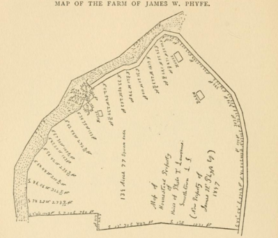
Along the river before San Remo, 1897
The map shows Landing Road, the old Greek camp, and part of San Remo.
Source: Records of the Town of Smithtown, Pelletreau.
Rate this file
(No vote yet)
Javascript must be enabled in order to vote
File information
Filename:
Screen_Shot_2018-12-04_at_9_43_27_PM.png
Album name:
dflynn
/
Maps
Keywords:
nissequogue river
/
san remo
/
kings park
Filesize:
558 KiB
Date added:
Dec 05, 2018
Dimensions:
768 x 656 pixels
Displayed:
414 times
URL:
http://kpheritagemuseum.net/cpg/displayimage.php?pid=2356
Favorites:
Add to Favorites