 Image search results - "river" Image search results - "river" |

691 views
|
|

607 views
|
|

585 views
|
|

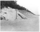
The Bluff c1963.761 views
|
|

Dredging Plan of the Nissequogue River, 1961.792 viewsThe plan was signed by Town Supervisor Brady, a Fort Salonga resident, having his office on Pulaski Blvd, Kings Park.
|
|

Mouth of the Nissequogue River, Hurricane Donna, Sept 1960833 views
|
|

The Bluff, Hurrican Donna, Sept 19601138 views
|
|

KPPC Boulevard 1978698 views
|
|

810 views
|
|

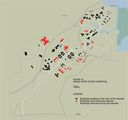
KPSH Map 1930s585 views
|
|

Kings Park Historic Map855 views
|
|

Lawrence House, Landing Road503 viewsLocated east of San Remo. Destroyed by 1970.
|
|

Delivering coal 1984.586 views
|
|

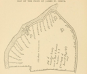
Along the river before San Remo, 1897365 viewsThe map shows Landing Road, the old Greek camp, and part of San Remo.
Source: Records of the Town of Smithtown, Pelletreau.
|
|

3439 views
|
|

The Bluff c1913943 views
|
|
|
|
