 Image search results - "san remo" Image search results - "san remo" |

Harrison's Pond (formerly "Harned's Pond"), early 1900s715 views
|
|

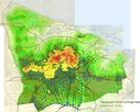
Relief Map of Kings Park657 viewsMap made in 2002 from 1954-56 USGS Topographic Maps.
|
|

Kings Park History Map739 views
|
|

Kings Park Historic Map766 views
|
|

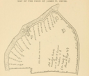
Along the river before San Remo, 1897283 viewsThe map shows Landing Road, the old Greek camp, and part of San Remo.
Source: Records of the Town of Smithtown, Pelletreau.
|
|
|
|
|
|
|
